Photographer
A. A. GLEASON
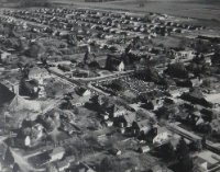
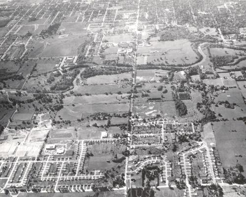
Aerial View of Stoneybrook Subdivision (Major arteries are Adelaide and Fanshawe Park Rd and you can see the Adelaide Street N. Bridge crossing the Thames River.)
DateAround 1963
MediumPHOTOGRAPHY
DimensionsOverall: 25.5 x 20.3 cm
Object number2004.020.191
Label TextStoneybrook Subdivision
Around 1963
South View (or Looking South)
London’s Stoneybrook subdivision flanks Fanshawe Park Road East (bottom) and Adelaide Street North (middle). The Thames River is in on its southern edge (middle) Development took off in the area from the 1960s, but so did efforts to preserve the natural heritage. From the 1970s, the city purchased land south of the river and east of Adelaide to create the Kilally Meadows Environmentally Sensitive Area.
NamePHOTOGRAPH